Vessup Beach
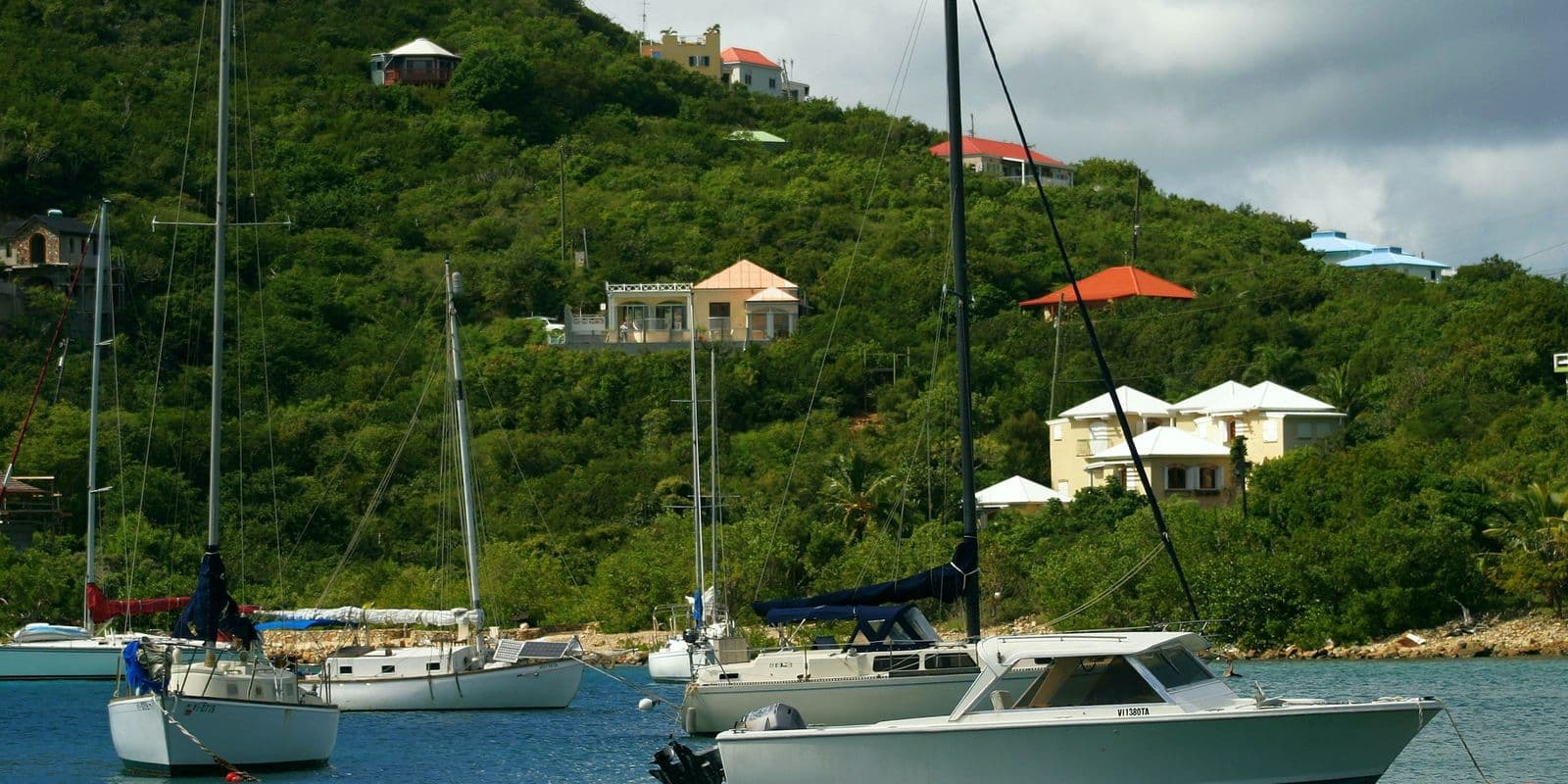
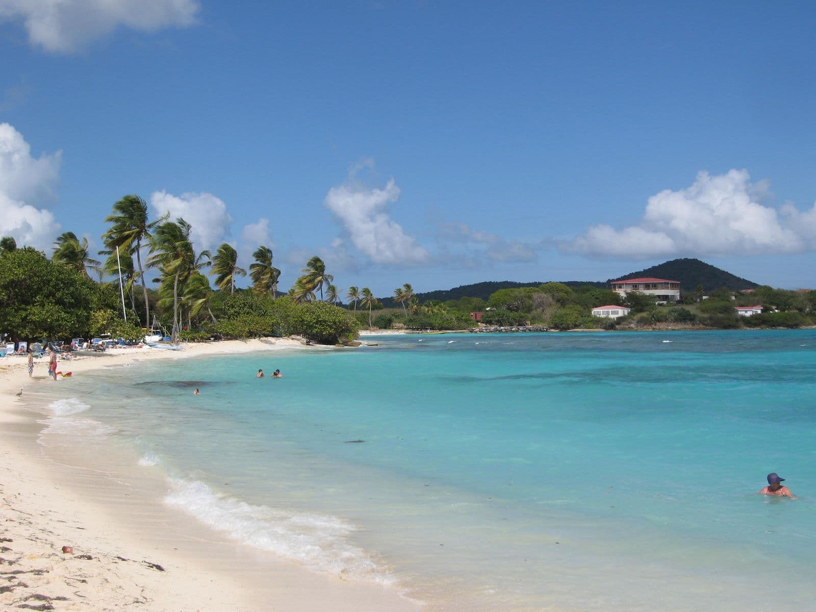
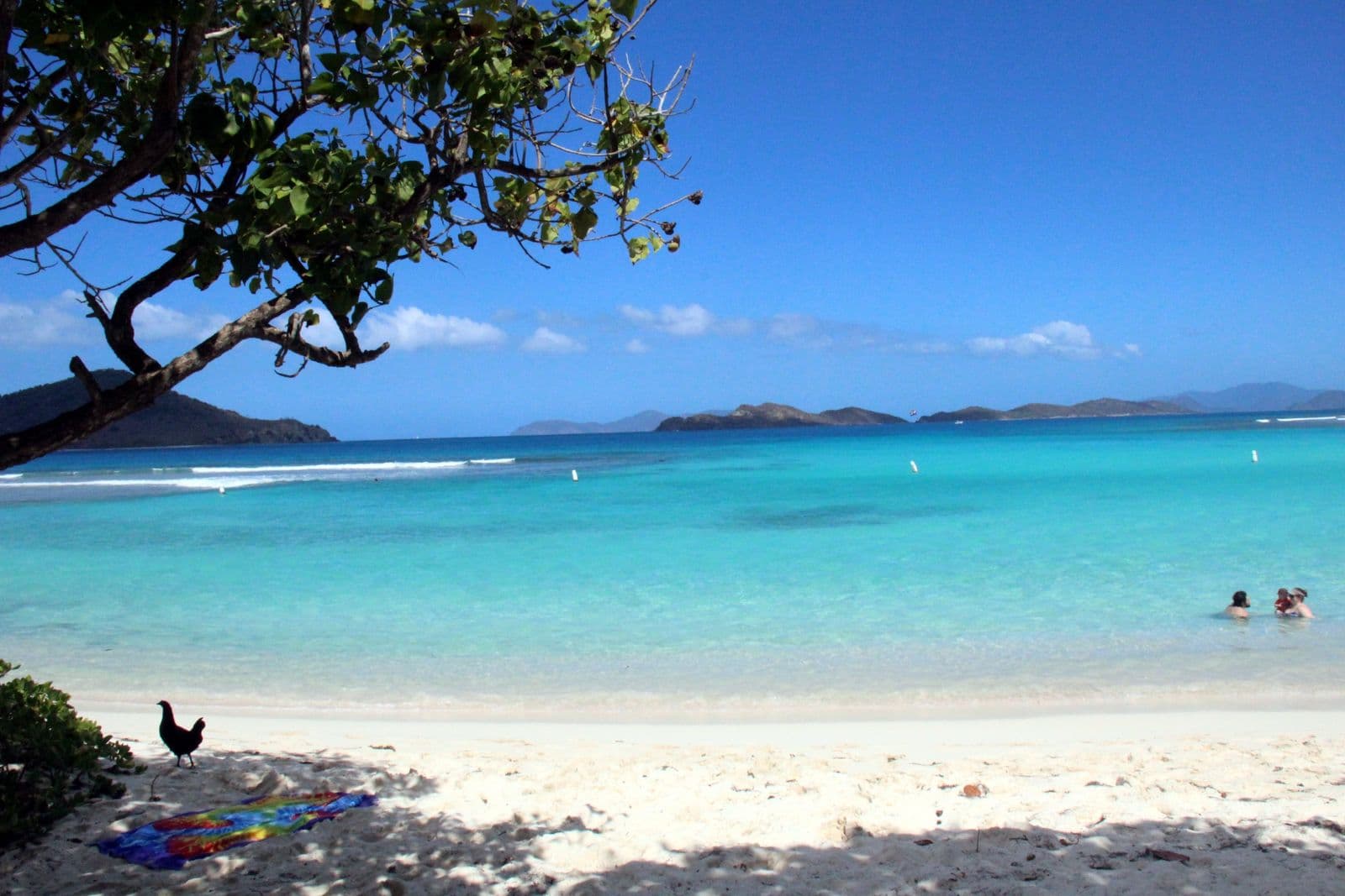
Vessup Beach is the undeveloped strand on the bay east of the Red Hook ferry terminal on St. Thomas, 6 minutes by car from the ferry. It is free, and the sand is public by law: the Superior Court said so of this beach in 2007 under the Open Shorelines Act. Below: the road in, the names, and the water.
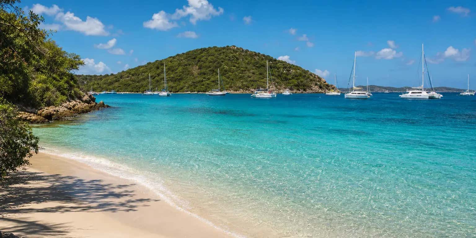
Conditions: Calm, sheltered water; sea grass is common in the water and washed up on the sand.
Vessup Beach at a glance
| Entry | Free |
|---|---|
| Hours | None posted, and no gate at the road end that we can find a record of (as of October 2026) |
| Parking | Informal, at the end of Vessup Beach Road; no lot (as of October 2026) |
| Restrooms | None |
| Shade | Some |
| Snorkeling | 2 of 5, Fair |
| Crowds | Moderate |
| Drive from Charlotte Amalie | about 27 minutes by car |
| Lifeguard | No |
Verified Oct 9, 2026.
Conditions today at Vessup Beach
As of 7:00 AM on Oct 16, 2026, island time. Read each morning from the National Weather Service, DPNR and Open-Meteo; the bay opens southeast, by our read from the map.
- Sea state
- Exposed. The swell is from the east at 0.9 m, period 5 seconds; Vessup Beach opens southeast, straight into it, so expect surf on the sand and stirred-up water.
Open-Meteo wave model at the nearest ocean cell; the bay's opening is our read from the map.
- Rip current risk
- Low. Surf around 3 feet, east winds around 15 mph.
National Weather Service San Juan, surf zone forecast for St Thomas, St John and adjacent islands, issued 3:51 AM.
- Water test
- Met the standard, week of Oct 9, 2026 (DPNR's site "Vessup Bay"). Met it in 62 of 63 weeks sampled since Aug 2, 2024. The advisory.
DPNR samples for Enterococci bacteria and turbidity weekly; a result after heavy rain can change within the week.
- Rain
- Dry through the day; the chance of rain peaks at 21%.
Open-Meteo hourly forecast at the pin.
- The day
- UV index up to 8; sunset 5:56 pm; sea 30 °C, 85 °F.
Open-Meteo.
Getting there
About 27 minutes by car from Charlotte Amalie. How to reach St. Thomas: Flights to St. Thomas, How to get around St. Thomas, St. Thomas airport, St. Thomas cruise port, St. Thomas map, St. Thomas weather by month, Things to do in St. Thomas.
Six minutes from the Red Hook ferry, around the bay
Vessup Beach is 6 minutes by car from the Red Hook ferry terminal and 27 minutes from Charlotte Amalie, by our measurement to the road beside the sand. The terminal is only about 500 meters away across the water, but the road has to go around the bay: 2.6 km, out of Red Hook on Route 32, left onto Route 322, then Bay Road and the short Vessup Beach Road down to the shore.
Parking is informal as of October 2026. Cars stop where the road meets the sand; there is no lot and no fee, and nobody publishes a count.
The terminal you can see across the water is the Urman Victor Fredericks Marine Terminal, which the Virgin Islands Port Authority runs for the St. John and Tortola ferries. It has a paid parking garage, restrooms, a bar and restaurants, per the Port Authority as of October 2026, which matters here because the beach has none of them.
Vessup Bay beach, St. Thomas: public by law
The sand at Vessup is public by law, whoever owns the land behind it. The Superior Court of the Virgin Islands said so of this beach in 2007, in Civil No. 172/2005, a case about two loose dogs on the shore. The court quoted the Open Shorelines Act, sections 402 and 403 of title 12 of the Virgin Islands Code: the public has the right to use and enjoy the shoreline, which runs from the line of low tide 50 feet inland, or to the vegetation line, whichever is shorter, and nobody may put an obstruction, barrier or restraint across it. The court noted that none of the properties were fenced, and wrote that an owner limiting access from the land side 'stands in opposition of the intent of the Open Shorelines Act', because the Act is meant to guarantee the beach to everyone, 'not just the boating elite'.
What that means in practice: the land above the vegetation line is private, and the strip below it is yours. The Department of Planning and Natural Resources, whose Division of Coastal Zone Management administers the 1978 Coastal Zone Management Act, says beaches cannot be fenced off and asks anyone denied a beach to report it to the Division. As of October 2026 Vessup Beach Road runs to the sand with no gate we can find a record of.
Which sand is Vessup Beach, and where is Muller Bay?
Vessup Beach is the strand on the south shore of the bay east of the Red Hook ferry terminal, the one Vessup Beach Road runs beside. The court record calls it 'the area commonly known as Vessup Beach', and that is the name on this page.
The federal names record uses the names differently. As OpenStreetMap carries it, Vessup Bay is the inner harbor where the Red Hook marinas are, and Muller Bay is the water off this shore, with a Muller Bay Beach label at the east end of the same sand. Between the west end of Vessup Beach Road and that label the mapped shoreline is unbroken, about 350 meters of it. So the sand the court and the island call Vessup and the sand the map calls Muller Bay Beach are, on our reading of the map, one shore under two names. No authority states it in so many words. The Port Authority names neither bay; its terminal is simply at Red Hook.
A residents' beach: weekend barbecues and no services
This is where St. Thomas residents spend a weekend, not a serviced beach. The shoreline is undeveloped, with trees and sea grape behind the sand that local accounts say give some shade, light during the week and a place for parties and barbecues at weekends, and dogs come too; the 2007 case was about two of them.
The tradeoff is that nothing is provided. No restroom, no lifeguard, no bar, no food. As of October 2026 we find no watersports stand or bar on this sand with a page of its own, so bring your own gear and water, and eat in Red Hook, 6 minutes back up the road, or at the ferry terminal.
Calm water and sea grass: a swimming beach
The water is calm, which is the reason to come: the bay is sheltered. Expect sea grass, in the water and washed up on the sand. St. John is across Pillsbury Sound to the east.
We rate the snorkeling 2 of 5: sea grass and sand, and no reef in any account we read, so the swim is the point. For a reef, Sapphire Beach is 4 minutes from the same ferry terminal and Coki Beach is 9.
Suits a weekday swim with a cooler, and anyone who would take a bare stretch of sand over a rented chair. Less so a visitor who needs a restroom or lunch on the sand.
Questions people ask about Vessup Beach
- Where is Vessup Beach?
- Vessup Beach is on the East End of St. Thomas, US Virgin Islands, on the south shore of the bay beside the Red Hook ferry terminal. It is reached by Vessup Beach Road, off Bay Road. The federal names record labels the water off it Muller Bay and the east end of the same sand Muller Bay Beach.
- Is there a fee at Vessup Beach?
- No. No fee is charged or listed as of October 2026, and the sand is public: the strip from the line of low tide to 50 feet inland, or to the vegetation line if that is shorter, is open to everyone under the Open Shorelines Act, which the Superior Court of the Virgin Islands applied to this beach in 2007. The land behind the sand is private.
- Do you need a car for Vessup Beach?
- A car is the easy way in: Vessup Beach is 6 minutes by car from the Red Hook ferry terminal and 27 from Charlotte Amalie, by our measurement. Parking is informal and free where Vessup Beach Road meets the sand, as of October 2026, and the terminal across the bay has a paid garage if the road end is full. Taxis here charge by the Virgin Islands Taxicab Commission's latest tariff, set in October 2022, which lists no Vessup stop; Red Hook, the nearest, is $20 from Charlotte Amalie for a single passenger or $15 each for two or more, and the tariff prices an unlisted stop from the nearest listed one, so ask the driver for the fare to the sand.
Written by Virgin Islands Villas. Facts verified Oct 9, 2026. Updated Oct 16, 2026.