virgin islands villas
Plan the trip

The Virgin Islands: St. John, St. Thomas, and the BVI

The Virgin Islands lie in the Caribbean just east of Puerto Rico, under two flags. St. John and St. Thomas are US territory, twenty minutes apart by ferry, with villas listed by their owners on this site; the British Virgin Islands sit a boat ride east, with listings opening in 2027. Start with the island, and the rest follows.

St. John
Flag
US territory
Reach
A 20-minute ferry from Red Hook on St. Thomas; no airport
Shape
Almost 58 percent national park; Cruz Bay is the town
Villas
Villas listed by their owners
The island page
St. Thomas
Flag
US territory
Reach
The airport and the cruise port; the ferry to St. John leaves from Red Hook
Shape
Charlotte Amalie, the territory's capital, and beaches on the north shore
Villas
Villas listed by their owners
The island page
British Virgin Islands
Flag
British overseas territory
Reach
By ferry from St. Thomas, passport in hand
Shape
Tortola, Virgin Gorda, Jost Van Dyke and Anegada, and more than fifty smaller islands and cays
Villas
Listings open in 2027
The island page

Getting there and around

The ferry, the barge, the airport and the car, with the minutes measured.

St. Thomas · Updated Oct 2026How to get around St. ThomasHow to get around St. Thomas comes down to one measurement: all 23 areas we list came out car required or recommended, so a rental is the default and…St. John · Updated Oct 2026How to get around St. JohnHow to get around St. John is a Jeep for most villas and a safari taxi for the rest: 20 of the 21 areas we list measured car required or recommended,…St. John · Updated Oct 2026The Westin St. John or a villa nearby?The Westin St. John suits a short stay with young children: a kids club, a pool and a beach on foot, 9 minutes from Cruz Bay, with no resort fee and…St. Thomas · Updated Oct 2026Flights to St. ThomasFlights to St. Thomas land at Cyril E. King Airport (STT), and six airlines fly there nonstop from the mainland US, from 14 cities, on the Virgin…St. Thomas · Updated Oct 2026St. Thomas airportSt. Thomas airport is Cyril E. King Airport, code STT, run by the Virgin Islands Port Authority two miles west of Charlotte Amalie: 12 minutes by car…St. John · Updated Oct 2026St. John resorts or a villa?St. John resorts are few. Three are run as resorts, on their operators' own pages as of October 2026: Gallows Point Resort in Cruz Bay, Lovango…St. John · Updated Oct 2026Airfare to St. John means a flight to St. ThomasAirfare to St. John, US Virgin Islands, is airfare to St. Thomas: St. John has no airport, so every trip lands at Cyril E. King Airport and finishes…St. John · Updated Oct 2026St. Thomas to St. John ferryThe ferry from St. Thomas to St. John runs from Red Hook to Cruz Bay in 20 minutes, about once an hour from 5:30 am, at $8.15 an adult one way as of…St. John · Updated Oct 2026Car ferry from St. Thomas to St. JohnThe car ferry from St. Thomas to St. John is a barge from Red Hook to the Theovald Moorehead Dock and Terminal at Enighed Pond in Cruz Bay, about 25…St. Thomas · Updated Oct 2026St. Thomas mapSt. Thomas is the westernmost of the three main US Virgin Islands, east of Puerto Rico, and the island every flight to St. John lands on. This map of…St. Thomas · Updated Oct 2026Things to do in St. ThomasThings to do in St. Thomas fall into five groups here: beaches, the water, the hills, a day trip to Jost Van Dyke, and the history and shops of…St. Thomas · Updated Oct 2026Margaritaville St. Thomas or a villa?Margaritaville St. Thomas is the Margaritaville Vacation Club St. Thomas, a Wyndham vacation-ownership resort on Water Bay at the East End, with…St. Thomas · Updated Oct 2026St. Thomas cruise portThe St. Thomas cruise port is two piers on Charlotte Amalie harbor: the West Indian Company Limited's dock at Havensight on the east side, and the…St. John · Updated Oct 2026Things to do in St. JohnThings to do in St. John happen mostly inside Virgin Islands National Park, which holds almost 58 percent of the island's land, per the National Park…St. Thomas · Updated Oct 2026St. Thomas all-inclusive resorts, or a villa?Of the St. Thomas all-inclusive resorts people search for, one sells an all-inclusive plan on its own site as of October 2026: Bolongo Bay Beach…St. John · Updated Sep 2026St. John mapSt. John is the easternmost of the three main US Virgin Islands, 20 minutes by passenger ferry from Red Hook on St. Thomas, and it has no airport.…

When to go

The months, the sea, the rain and the hurricane odds, from the records.

The beaches

Every beach with its fee, parking, snorkeling and the drive from town, and a conditions log kept up as reports arrive.

Where to stay

The neighborhoods, one page each, written to the drive times and the roads.
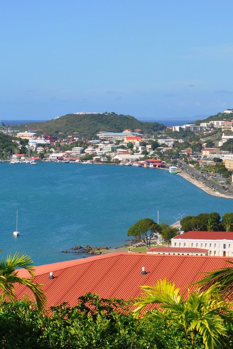
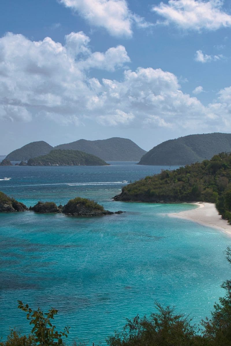
St. Thomas · Updated Oct 2026Red Hook, St. ThomasRed Hook, St. Thomas, is the harbor at the East End where the St. John ferry and the car barge leave, with American Yacht Harbor on the same…St. Thomas · Updated Oct 2026Sapphire Bay, St. ThomasSapphire Bay is the shore on the East End of St. Thomas where the Sapphire Beach condos look across the water to St. John, with more condominiums on…St. Thomas · Updated Oct 2026Point Pleasant, St. ThomasPoint Pleasant, St. Thomas, is the stretch of the north-east shore above Water Bay, and much of what carries the name is Point Pleasant Resort, on…St. Thomas · Updated Oct 2026Cabrita Point, St. ThomasCabrita Point, St. Thomas, is the headland at the island's eastern end, where houses on steep slopes face St. John and Great St. James, with the…St. Thomas · Updated Oct 2026Smith Bay, St. ThomasSmith Bay is the north-east shore of St. Thomas along Smith Bay Road, where Coral World Ocean Park, Coki Beach and Smith Bay Park share a short…St. Thomas · Updated Oct 2026Magens Bay, St. ThomasMagens Bay, St. Thomas, is the low shore and the estates behind the public beach park on the north side, the one area on our map where that beach is…St. Thomas · Updated Oct 2026Peterborg, St. ThomasPeterborg, St. Thomas, is the steep peninsula beside Magens Bay on the island's north side, a ridge of houses with the sea below. It suits a family…St. Thomas · Updated Oct 2026Mahogany Run, St. ThomasMahogany Run is steep hillside on the north side of St. Thomas, east of Magens Bay, named for its golf course and covering Lovenlund, Wintberg and…St. Thomas · Updated Oct 2026Hull Bay, St. ThomasHull Bay, St. Thomas, is a fishing bay on the island's north coast, west of Magens Bay, with a beach at the water and steep estates above it. It…St. Thomas · Updated Oct 2026Tutu, St. ThomasTutu is the inland errand center of St. Thomas, US Virgin Islands, the valley around Tutu Park Mall in Anna's Retreat, where the island does its…St. Thomas · Updated Oct 2026Frenchman's Bay, St. ThomasFrenchman's Bay is the stretch of St. Thomas's south shore east of Charlotte Amalie harbor, home to Frenchman's Reef, Marriott's Frenchman's Cove and…St. Thomas · Updated Oct 2026Bolongo, St. ThomasBolongo, St. Thomas, is the hillside neighborhood around Bolongo Bay on the island's south shore, east of Frenchman's Bay: ground that measures steep…St. Thomas · Updated Oct 2026Secret Harbour, St. ThomasSecret Harbour, St. Thomas, is a small bay on the south shore of the East End, where the Secret Harbour Beach Resort's condominiums meet the sand. It…St. Thomas · Updated Oct 2026Bluebeard's, St. ThomasBluebeard's, St. Thomas, is the hill on the east side of Charlotte Amalie harbor, named for the Danish tower at Bluebeard's Castle Resort, with the…St. Thomas · Updated Oct 2026Nazareth, St. ThomasEstate Nazareth, St. Thomas, is the stretch of the East End between Red Hook and the Secret Harbour Beach Resort, with the St. Thomas Yacht Club and…St. Thomas · Updated Oct 2026Charlotte Amalie, St. ThomasCharlotte Amalie is the capital of the US Virgin Islands, the harbor town on the south coast of St. Thomas, between the cruise docks at Havensight…St. Thomas · Updated Oct 2026Frenchtown, St. ThomasFrenchtown, St. Thomas is the small harbor neighborhood at the western edge of Charlotte Amalie, settled by fishing families from St. Barthélemy, and…St. Thomas · Updated Oct 2026Fortuna, St. ThomasFortuna, St. Thomas, is the far west end of the island: steep ground beyond Cyril E. King Airport, with Estate Botany Bay on the point past it. A…St. Thomas · Updated Oct 2026Bordeaux, St. ThomasBordeaux, St. Thomas, is the hill country of the island's west end, on our area map from the University of the Virgin Islands to Estate Bordeaux. It…St. Thomas · Updated Oct 2026Water Island, St. ThomasWater Island lies off the south coast of St. Thomas, a small island with no road or bridge to the main one, reached by the Water Island Ferry from…Charlotte Amalie harbor, St. Thomas, framed by palms and a red roof, with boats at anchor and the town on the hillside.St. ThomasWhere to stay on St. ThomasEvery area compared: the drive to town and the ferry, whether you need a car, how steep the roads are.St. John · Updated Oct 2026Great Cruz Bay, St. JohnA sheltered bay on the south side of St. John with the Westin at its head, 12 minutes by car from Cruz Bay. Most of the houses on the hill above face…St. John · Updated Oct 2026Cruz Bay, St. JohnCruz Bay is St. John's ferry town and the only place on the island where dinner is a walk: restaurants, the Park visitor center and Mongoose Junction…St. John · Updated Oct 2026Chocolate Hole, St. JohnA residential hillside between Cruz Bay and Great Cruz Bay, 7 minutes from town. Wide views west to St. Thomas and the sunset. Mostly private houses…St. John · Updated Oct 2026Rendezvous Bay, St. JohnRendezvous Bay is a residential bay on the south shore of St. John, USVI, with private villas above Klein Bay and Ditleff Point and no shop or…St. John · Updated Oct 2026Fish Bay, St. JohnFish Bay, St. John is a hillside of private houses above a bay on the island's south shore, 17 minutes by car from Cruz Bay town by our measurement.…St. John · Updated Oct 2026Gifft Hill, St. JohnGifft Hill, St. John, USVI, is the ridge of private houses between Cruz Bay and the south shore bays, about 650 feet up at its middle by our…St. John · Updated Oct 2026Peter Bay, St. JohnPeter Bay, St. John, is the private hillside between Trunk Bay and Cinnamon Bay on the North Shore, where a villa stands above a beach you walk to.…St. John · Updated Oct 2026Catherineberg, St. JohnCatherineberg, St. John, USVI is the ridge above the North Shore: houses along Centerline Road in the middle of the island, around a sugar mill ruin…St. John · Updated Oct 2026Bordeaux Mountain, St. JohnBordeaux Mountain, St. John is the ridge above Centerline Road on the way to Coral Bay, the island's highest ground at 1,286 feet per the National…St. John · Updated Oct 2026Coral Bay, St. JohnThe east side of St. John, 28 minutes from the Cruz Bay ferry over the mountain road. Slower and more spread out than Cruz Bay, with a handful of…St. John · Updated Oct 2026Johns Folly, St. JohnJohns Folly is the stretch of St. John's southeast coast between Coral Bay harbor and Salt Pond Bay: steep hillsides, villas spread up them and a…St. John · Updated Oct 2026East End, St. JohnThe East End is the far reach of St. John, past Coral Bay, where Route 10 runs out along the eastern arm above small bays. St. John East End rentals…St. John · Updated Oct 2026Lovango Cay, St. JohnLovango Cay is a private island off St. John's north-west coast, with no cars but the resort's own. It suits a couple or a small group content to…Trunk Bay and Trunk Cay from the North Shore Road overlook on St. John, under broken cloud.St. JohnWhere to stay on St. JohnEvery area compared: the drive to town and the ferry, whether you need a car, how steep the roads are.
Booking direct

What a villa page shows, what you pay, and the lists with a point of view.

The siteHow booking direct worksYou write to the owner, agree the details, and pay them directly. No service fee, and no account needed.USVIThe US Virgin Islands, the factsThe flag, the governor, the clock and the paperwork: the territory's quick answers, each with its source.Both islandsCollectionsNineteen lists across both islands: golden hour, nobody in sight, for two, bring the dog.Both islands · Updated Oct 2026The Virgin Islands mapThe Virgin Islands lie just east of Puerto Rico in a line you can take in from one hilltop: St. Thomas first, then St. John across a sound about 2…Both islands · Updated Oct 2026Ferry from St. Thomas to TortolaThe ferry from St. Thomas to Tortola leaves from two docks as of October 2026: Charlotte Amalie, up to three sailings a day shared by three…Both islands · Updated Oct 2026USVI ferry routes: times, fares and the last boatThe USVI ferry a visitor takes most is Red Hook to Cruz Bay, 20 minutes and $8.15 an adult, hourly until 11:30 pm as of October 2026. Eight other…Both islands · Updated Oct 2026The best Virgin Island to visit, by the week you wantThe best Virgin Island to visit on a first trip is St. John or St. Thomas, and the choice turns on the ferry. St. Thomas puts most houses 28 minutes…Both islands · Updated Oct 2026Christmas in the Virgin Islands, from Thanksgiving to spring breakChristmas in the Virgin Islands comes as the dry season starts: December at the St. Thomas airport station averages 85 degrees and 2.9 inches of…Both islands · Updated Oct 2026US Virgin Islands family vacationA US Virgin Islands family vacation starts with one choice: St. Thomas, where the plane lands, or St. John, a taxi and a 20-minute ferry beyond it.…Both islands · Updated Oct 2026Driving in St. Thomas and St. John, US Virgin IslandsDriving in St. Thomas, USVI, means keeping left on hill roads slower than the map suggests: Cyril E. King Airport to the Red Hook ferry is 36 minutes…Both islands · Updated Oct 2026US Virgin Islands bachelorette partyA US Virgin Islands bachelorette party is usually eight to twelve people in one house, and most of the planning is moving them around. The roads are…St. Thomas · Updated Oct 2026Mountain Top, St. Thomas, and the sunset overlooksMountain Top, St. Thomas, is an overlook for the daytime: the deck on St. Peter Mountain is open 9 am to 5 pm, per Mountain Top's own site, checked…St. Thomas · Updated Oct 2026A St. Thomas honeymoon, planned from where you stayA St. Thomas honeymoon is decided by where you sleep. The airport to Red Hook is 36 minutes by car, and the side you choose sets how far dinner is:…St. Thomas · Updated Oct 2026Fort Christian, St. ThomasFort Christian, St. Thomas's Danish fort on the Charlotte Amalie waterfront, was built between 1672 and 1680 and has been a National Historic…St. John · Updated Oct 2026A St. John honeymoon, decided by the house and the road to itA St. John honeymoon happens inside a national park: almost 58 percent of the island's land is park, per the National Park Service. The house shapes…St. Thomas · Updated Oct 2026St. Thomas nightlifeSt. Thomas nightlife gathers in two places: Red Hook on the East End, and the Charlotte Amalie harbor from Frenchtown to Yacht Haven Grande. They are…Both islands · Updated Oct 2026Do you need a passport for St. Thomas and the US Virgin Islands?No. A US citizen flying from the mainland needs no passport for St. Thomas, St. John or St. Croix as of October 2026, per US Customs and Border…St. John · Updated Oct 2026St. John family guide: traveling with kidsA St. John family trip turns on the calm North Shore bays, where the National Park Service names Maho Bay and Francis Bay for families and beginners,…St. John · Updated Oct 2026St. John day trips: a week planned by the driveSt. John day trips are short drives with real limits. The farthest beach lot we measured, Little Lameshur, is 45 minutes from Cruz Bay, but the lots…Both islands · Updated Oct 2026US Virgin Islands weather by monthUS Virgin Islands weather hardly moves in temperature; rain and storms decide the trip. For the driest sky, the best time to visit the US Virgin…St. Thomas · Updated Oct 2026Things to do in St. Thomas with kidsThe things to do in St. Thomas with kids come down to three gates and a few calm beaches: Coral World Ocean Park, the Skyride to Paradise Point and…St. Thomas · Updated Oct 2026A St. Thomas sailing itinerary, from a house on landA St. Thomas sailing itinerary can run from a house as well as a boat: a week with three days on the water and four on land. The water days take in…Both islands · Updated Oct 2026What to wear in St. Thomas and St. John, and what to packWhat to wear in St. Thomas is light, loose clothing: the normal high at Cyril E. King Airport runs from 84°F in January to 90°F in summer, and no…Both islands · Updated Oct 2026From the Danish Virgin Islands to the US Virgin IslandsThe Danish Virgin Islands, the colony Denmark called the Danish West Indies, became the US Virgin Islands when the United States bought St. Thomas,…St. John · Updated Oct 2026Annaberg Sugar PlantationThe Annaberg Sugar Plantation is the ruin of the largest sugar estate on St. John, on the North Shore above Leinster Bay inside Virgin Islands…Both islands · Updated Oct 2026The Painkiller drink: two recipes from one beachA Painkiller drink is dark rum, pineapple juice, orange juice and cream of coconut over ice, with nutmeg grated on top. Two operators publish the…Both islands · Updated Oct 2026Is St. Thomas safe? Safety in the US Virgin IslandsIs St. Thomas safe? As of October 2026, no police or health agency publishes a figure that answers it: the Virgin Islands Police Department's website…

Where are the Virgin Islands?

Two territories and a corner of Puerto Rico, in one chain of islands.

At the northern end of the Lesser Antilles, where the Caribbean meets the Atlantic, and the chain is split three ways. The border between the first two runs through the channel between St. John and Tortola; the map of the whole chain shows it.

The line matters more than the distance. Crossing it, even for a lunch on Jost Van Dyke, takes a passport book to enter the BVI, so decide which side you are staying on before anything else.

Questions about the islands

The two asked most often, answered from the government that counts its own islands.

How many islands are in the Virgin Islands?
No one count covers the whole chain, because it depends on whether a cay or a rock counts. The BVI government lists four main islands and more than fifty smaller islands and cays, about 15 of them inhabited.
What are the Virgin Islands?
An island chain east of Puerto Rico shared by two territories: the US Virgin Islands and the British Virgin Islands, whose own government calls them simply the Virgin Islands. Culebra and Vieques, at the western end, are part of Puerto Rico.

Written by Virgin Islands Villas. Facts checked against the BVI government. Checked October 2026.