Hansen Bay
Hansen Bay beach is on the East End of St. John, 39 minutes by car from Cruz Bay. It lies outside Virgin Islands National Park, on a shoreline the Virgin Islands Code (12 V.I.C. § 402, read October 2026) says the public may use, behind private land. Below: the drive, the law, what to expect, and Haulover Bay.
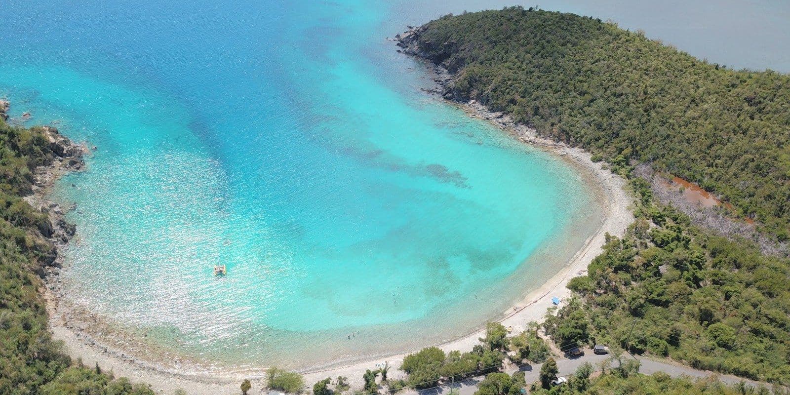
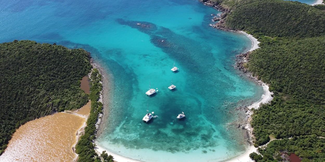
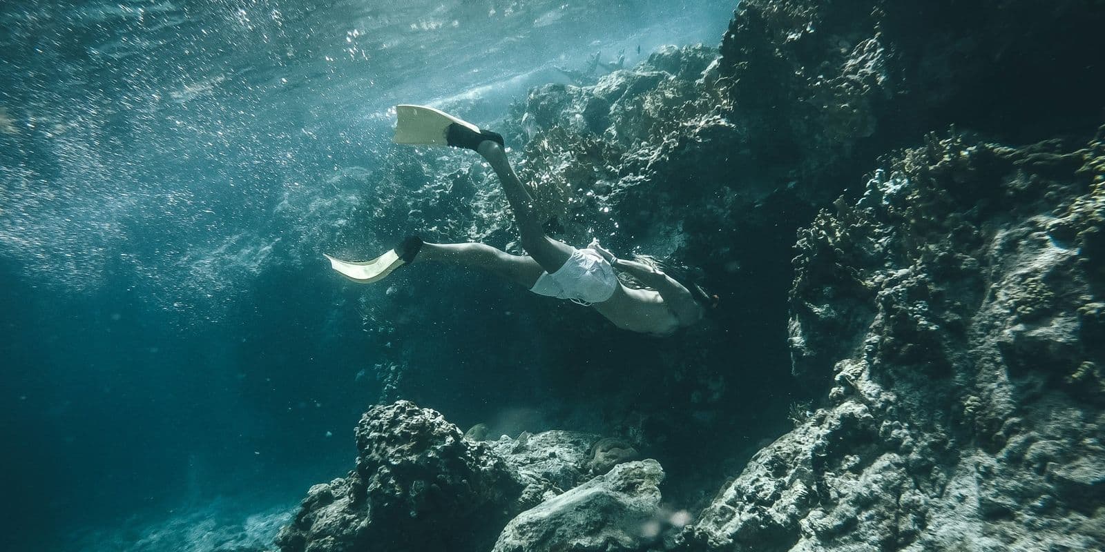
Conditions: A small bay at the eastern end of Coral Bay, which the local guides we read describe as often calm and clear; the snorkeling they name is at Pelican Rock, off the left end of the beach. No source we opened describes a current, and nobody publishes a lifeguard.
Hansen Bay at a glance
| Entry | No fee published; a parking donation is asked by the family whose land the parking is on (the local guides, read Oct 8, 2026; no operator publishes it) |
|---|---|
| Hours | None published: the shore is public at any hour, and the parking on the family's land is theirs to allow (our read) |
| Parking | On private land beside East End Road, where the owners allow it |
| Restrooms | Seasonal or limited |
| Shade | Sparse |
| Snorkeling | 4 of 5, Very good |
| Crowds | Quiet |
| Drive from Cruz Bay | about 39 minutes by car |
| Lifeguard | No |
Verified Oct 9, 2026.
Conditions today at Hansen Bay
As of 7:00 AM on Oct 16, 2026, island time. Read each morning from the National Weather Service, DPNR, the National Park Service and Open-Meteo; the bay opens southwest, by our read from the map.
- Sea state
- Sheltered. The swell is from the east at 0.9 m, period 4 seconds; Hansen Bay opens southwest, so the bay sits in the lee.
Open-Meteo wave model at the nearest ocean cell; the bay's opening is our read from the map.
- Rip current risk
- Low. Surf around 3 feet, east winds around 15 mph.
National Weather Service San Juan, surf zone forecast for St Thomas, St John and adjacent islands, issued 3:51 AM.
- Water test
- Not a site in DPNR's weekly programme, which samples St. John only some weeks.
Department of Planning and Natural Resources, Beach Water Quality Monitoring Program.
- Park alerts
- No alert names Hansen Bay; the park posts 1 alert today.
National Park Service, Virgin Islands National Park alerts.
- Rain
- Dry through the day; the chance of rain peaks at 21%.
Open-Meteo hourly forecast at the pin.
- The day
- UV index up to 8; sunset 5:55 pm; sea 30 °C, 85 °F.
Open-Meteo.
Getting there
About 39 minutes by car from Cruz Bay. How to reach St. John: Airfare to St. John means a flight to St. Thomas, Car ferry from St. Thomas to St. John, How to get around St. John, St. John map, St. John weather by month, St. Thomas to St. John ferry, Things to do in St. John.
How to get to Hansen Bay from St. Thomas
The usual way: a taxi to the Red Hook ferry terminal (36 min), then the ferry to Cruz Bay (20 min, $8.15 a person), then 39 minutes by road from Cruz Bay to Hansen Bay. About 95 minutes from Cyril E. King airport to Hansen Bay, more on cruise-ship days. Six other ways across are below, with times and fares.Every route
The boat if you are stepping off a cruise ship or staying downtown: it leaves from the waterfront terminal, twice a day each way.
- Ferry, Charlotte Amalie to Cruz Bay45 min
Plus $4 a bag; $3.50 child; $6 for residents 60 and over with the elderly IDTwo a day each way: 8:45 and 11:15 am from Cruz Bay, 10 am and 12:30 pm from Charlotte Amalie (Transportation Services of St. John)Varlack Ventures lists its own Charlotte Amalie run as suspended for the off-season, as of October 2026; check its page before you plan on that boatNo reservationTimes (Transportation Services of St. John and Varlack Ventures)
45 min$13 a person$12 resident
The closest boat to the airport and the fastest door to dock, but two sailings a day, four Friday to Sunday. It lands at Cruz Bay Creek, not the main ferry dock.
- Taxi to Crown Bay Marina8 min
- Boat to Cruz Bay Creek35 min
Boat only; $15 senior, $10 child 3 to 11. The taxi to Crown Bay is $8 for one rider, $6 each for two or more.3:30 and 5:30 pm daily; 9:45 am and 2:15 pm Friday to SundayCheck in 30 minutes before departureTimes (Inter Island Boat Services)
43 min$20 a personThe route most guests take. The taxi is the long part; allow extra on cruise-ship days and at school-run time.
- Taxi to the Red Hook ferry terminal36 min
- Ferry to Cruz Bay20 min
Ferry only, plus $4 a bag. The taxi to Red Hook is $23 for one rider, $17 each for two or more.Ferry hourly, 5:30 am to 10 pmNo reservationTimes (VITRAN, run by Transportation Services and Varlack Ventures)
56 min$8.15 a person$6 residentRarely the best choice from the airport: the terminal is closer than Red Hook, but the crossing is twice as long and only two boats a day leave Charlotte Amalie.
- Taxi to the Charlotte Amalie ferry terminal12 min
- Ferry to Cruz Bay45 min
Ferry only, plus $4 a bag. The taxi to the terminal is $11 for one rider, $9 each for two or more.Two a day from Charlotte Amalie, 10 am and 12:30 pm (Transportation Services of St. John)Varlack Ventures' Charlotte Amalie run was suspended for the off-season in October 2026; it usually sails again from about November, so check its page firstTimes (Transportation Services of St. John and Varlack Ventures)
57 min$13 a person$12 residentYour own boat on your own schedule, any hour with notice. Priced by the boat, from $695, so it makes sense for a full house arriving together. The operator does not publish the crossing time, so no total is shown.
- Taxi to Crown Bay Marina8 min
- Water taxi to Cruz Bay
The boat, not the seat; the operator quotes from $695 from Crown Bay and from $495 from Compass Point Marina. The land taxi to Crown Bay is $8 for one rider, $6 each for two or more.By reservation; 24-hour service with notice
from $695 a boat
- FerryThe Red Hook ferry
The default way over: hourly until 10 pm, no booking, and it lands at the main dock in the middle of Cruz Bay.
- Ferry, Red Hook to Cruz Bay20 min
Plus $4 a bag. Varlack adds a fuel surcharge from June 12, 2026.Hourly, 5:30 am to 10 pm from Red Hook, 6 am to 10 pm from Cruz Bay; an off-season timetable runs from late July, usually to the end of October, so check the operator's current scheduleNo reservation; buy at the windowTimes (VITRAN, run by Transportation Services and Varlack Ventures)
20 min$8.15 a person$6 resident - Car bargeThe car barge
Only with your own car, or a rental whose company allows the crossing: National and Discount Car Rental say theirs may go (their own pages, 2026-10-09), so ask yours first. Most people rent on St. John. The crossing time is not published, so no total is shown.
- Car barge to the Theovald Moorehead terminal at Enighed Pond
Times (Big Red Barge, Love City Car Ferries and Global Marine)
$65 a car one way, $80 round trip, on the Big Red Barge and Love City Car Ferries rates pages (checked 2026-10-09). Each company sells its own tickets.
Fares change; the operator's page has today's. Road legs measured on island roads. Taxi fares are the Virgin Islands Taxicab Commission's tariff, in force since October 2022: per person, less each for two or more traveling together, plus $3 a bag. Checked 2026-10-09.
Thirty-nine minutes from Cruz Bay, through Coral Bay
Hansen Bay is 39 minutes by car from Cruz Bay, across the island and through Coral Bay, then out East End Road, which is Route 10. It is the far end of the drive: Haulover Bay, the last beach the National Park Service lists on this road, comes a minute sooner. Anyone staying on St. Thomas crosses first on the Red Hook ferry, and the drive east from the Cruz Bay dock needs a rented car or a taxi. The Virgin Islands Taxicab Commission's tariff has no Hansen Bay stop; the nearest it lists, the one it calls Vie's (East End), is $38 for one person or $25 each for two or more from Cruz Bay, or $12 or $11 from Coral Bay, on the 2022 schedule still in force. Coral Bay is the last village on the road, and nothing at the beach is published, so pack lunch and water before you set off.
Is Hansen Bay a private beach?
The shore is not; the land behind it is. The Open Shorelines Act declares, in section 402, that the public's right to use the territory's shorelines continues, and section 403 bars any barrier on them that gets in the way of that use. The protected strip begins where the sea stands at low tide and reaches 50 feet up the beach, stopping sooner at the first continuous vegetation or a natural barrier. The Department of Planning and Natural Resources, which runs Coastal Zone Management, puts the rule in five words: beaches cannot be fenced off.
The Act gives no right to cross private land to reach that strip. Hansen Bay lies outside Virgin Islands National Park on the National Park Service's own boundary data, so there is no park lot and no park path here. That is where the word private comes from: the sand by the water is yours to use, and the ground between the road and it is somebody's land.
The question has been tested here. On Mar 29, 2014 the St. John Source reported a fence, no-trespassing signs and a tarp-roofed hut on a narrow strip of beach at Hansen Bay; the head of Coastal Zone Management told the paper the owner did not have to provide access across the property, since the beach could be reached from the water. The Superior Court went further in Kosick v. Bar-Sela, a St. Thomas case it decided by memorandum on Apr 2, 2007, writing that it was "troubled" by the argument that the Act lets an owner limit access from the land side, because "encouraging beach property owners to restrict access to the beach via land will limit use" of the shore. In practice you reach Hansen Bay across land a family allows you to cross, on their terms.
What to expect at Hansen Bay beach, St. John
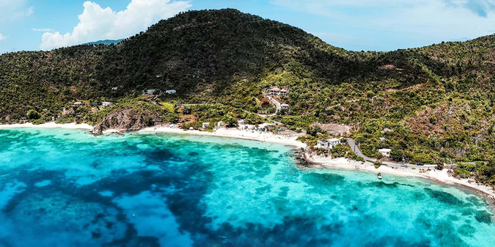
Expect a short sandy beach and terms that no agency or owner publishes, so what follows is only what the local guides we read in October 2026 agree on.
A family that owns land beside the bay lets visitors park on it and walk down, and asks a donation for the parking. The guides do not agree on an amount and no operator publishes one, so carry small bills and settle it with whoever greets you. Two guides, dated 2020 and 2021, describe chairs, kayaks and paddle boards to rent on the same land; none of it is confirmed for October 2026, and no source publishes hours.
Plan for very little. Two local accounts, from 2020 and July 2025, describe portable toilets on the family's land, which is as far as anyone goes; the guides contradict each other on food and drink, and the shade, in the latest account, is a few palms. Bring lunch, water and something to sit under. The water is the reason to come this far; swim it as if nobody is watching.
The tradeoff is the distance, and the uncertainty at the end of it. Thirty-nine minutes each way, past the last village on the road, to a beach that stays open to cars because a family allows it, on terms that can change without notice.
Choosing between Haulover Bay and Hansen Bay
Haulover if you want the terms set by an agency; Hansen Bay if you want sand and somewhere to leave the car. Haulover is park land, with no fee and, as of October 2026, no pets and no glass on the beach, and its two beaches are pebble with little sand in the National Park Service's description. Hansen Bay, by the local guides we read in October 2026, has soft sand and a family's land to park on, on that family's terms. A minute separates them on the road from Cruz Bay, so the drive does not decide it; sand against stones, and a host against a park, does.
Suits a second or third trip, a day already planned around Coral Bay, and a driver content to ask permission and leave a donation; not a first morning on the island or anyone who wants the fee and the facilities fixed in writing before leaving town.
Questions people ask about Hansen Bay
- Is Hansen Bay a private beach?
- The shoreline is not. Under the Open Shorelines Act, 12 V.I.C. § 402, the public may use the shore of the territory for 50 feet in from the low-water mark, and § 403 bars fences across it. The land behind that strip is private and outside the National Park, so you cross and park where the owners allow it.
- Where is Hansen Bay beach on St. John, USVI?
- At the far East End of St. John, in the US Virgin Islands, past Coral Bay on East End Road (Route 10) and outside Virgin Islands National Park. The park's two beaches at Haulover Bay are a minute closer to Cruz Bay on the same road.
- How do you get to Hansen Bay from St. Thomas?
- The Red Hook ferry carries you over to Cruz Bay, and from there it is a 39-minute drive by way of Coral Bay, by our October 2026 measurement on the road network. Parking is on a family's land beside the bay, where they allow it.
- Is there a fee at Hansen Bay beach?
- No fee is published as of October 2026. The parking is on a family's land and the local guides we read agree a donation is asked, without agreeing on an amount, so bring small bills. No park fee applies, because the beach is outside Virgin Islands National Park.
Written by Virgin Islands Villas. Facts verified Oct 9, 2026. Updated Oct 16, 2026.