Lameshur Bay
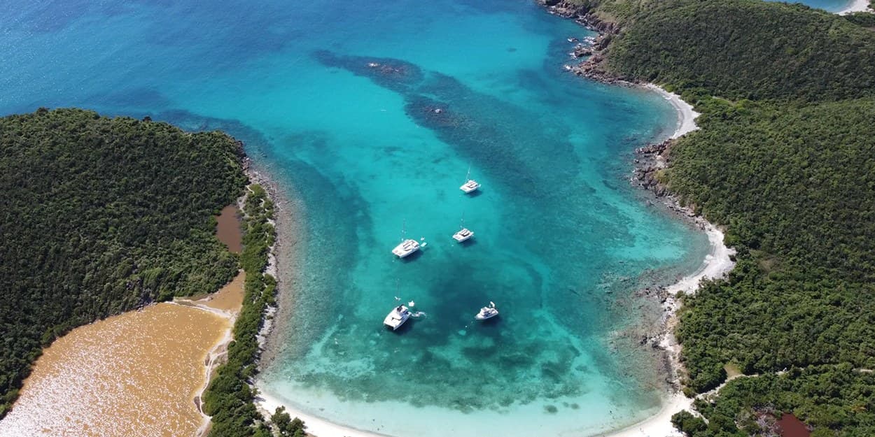
Lameshur Bay on St. John is two park beaches on the south shore, rocky Great Lameshur and sandy Little Lameshur, free per the National Park Service as of October 2026. The lot is 45 minutes from Cruz Bay, the park recommends four-wheel drive for the last stretch, and no closure was posted on Oct 8, 2026.
Conditions: Little Lameshur is the sheltered swim of the two; the waves build toward Yawzi Point, and at Great Lameshur they can get large near the point. After heavy rain the access road holds standing water, which is the reason the federal rebuild plans new low water crossings (St. John Source, Dec 15, 2025).
Lameshur Bay at a glance
| Entry | Free |
|---|---|
| Hours | The park is open 24 hours a day, year-round (NPS); no separate hours are posted for these beaches |
| Parking | A dirt lot and roadside spaces beside Little Lameshur; the federal road plans add a lot by Great Lameshur |
| Restrooms | Seasonal or limited |
| Shade | Some |
| Snorkeling | 4 of 5, Very good |
| Crowds | Quiet |
| Drive from Cruz Bay | about 45 minutes by car |
| Lifeguard | No |
Verified Oct 9, 2026.
Conditions today at Lameshur Bay
As of 7:00 AM on Oct 16, 2026, island time. Read each morning from the National Weather Service, DPNR, the National Park Service and Open-Meteo; the bay opens south, by our read from the map.
- Sea state
- Sheltered. The swell is from the east at 0.9 m, period 5 seconds; Lameshur Bay opens south, so the bay sits in the lee.
Open-Meteo wave model at the nearest ocean cell; the bay's opening is our read from the map.
- Rip current risk
- Low. Surf around 3 feet, east winds around 15 mph.
National Weather Service San Juan, surf zone forecast for St Thomas, St John and adjacent islands, issued 3:51 AM.
- Water test
- Not a site in DPNR's weekly programme, which samples St. John only some weeks.
Department of Planning and Natural Resources, Beach Water Quality Monitoring Program.
- Park alerts
- No alert names Lameshur Bay; the park posts 1 alert today.
National Park Service, Virgin Islands National Park alerts.
- Rain
- Dry through the day; the chance of rain peaks at 21%.
Open-Meteo hourly forecast at the pin.
- The day
- UV index up to 8; sunset 5:55 pm; sea 30 °C, 85 °F.
Open-Meteo.
Getting there
About 45 minutes by car from Cruz Bay. How to reach St. John: Airfare to St. John means a flight to St. Thomas, Car ferry from St. Thomas to St. John, How to get around St. John, St. John map, St. John weather by month, St. Thomas to St. John ferry, Things to do in St. John.
How to get to Lameshur Bay from St. Thomas
The usual way: a taxi to the Red Hook ferry terminal (36 min), then the ferry to Cruz Bay (20 min, $8.15 a person), then 45 minutes by road from Cruz Bay to Lameshur Bay. About 101 minutes from Cyril E. King airport to Lameshur Bay, more on cruise-ship days. Six other ways across are below, with times and fares.Every route
The boat if you are stepping off a cruise ship or staying downtown: it leaves from the waterfront terminal, twice a day each way.
- Ferry, Charlotte Amalie to Cruz Bay45 min
Plus $4 a bag; $3.50 child; $6 for residents 60 and over with the elderly IDTwo a day each way: 8:45 and 11:15 am from Cruz Bay, 10 am and 12:30 pm from Charlotte Amalie (Transportation Services of St. John)Varlack Ventures lists its own Charlotte Amalie run as suspended for the off-season, as of October 2026; check its page before you plan on that boatNo reservationTimes (Transportation Services of St. John and Varlack Ventures)
45 min$13 a person$12 resident
The closest boat to the airport and the fastest door to dock, but two sailings a day, four Friday to Sunday. It lands at Cruz Bay Creek, not the main ferry dock.
- Taxi to Crown Bay Marina8 min
- Boat to Cruz Bay Creek35 min
Boat only; $15 senior, $10 child 3 to 11. The taxi to Crown Bay is $8 for one rider, $6 each for two or more.3:30 and 5:30 pm daily; 9:45 am and 2:15 pm Friday to SundayCheck in 30 minutes before departureTimes (Inter Island Boat Services)
43 min$20 a personThe route most guests take. The taxi is the long part; allow extra on cruise-ship days and at school-run time.
- Taxi to the Red Hook ferry terminal36 min
- Ferry to Cruz Bay20 min
Ferry only, plus $4 a bag. The taxi to Red Hook is $23 for one rider, $17 each for two or more.Ferry hourly, 5:30 am to 10 pmNo reservationTimes (VITRAN, run by Transportation Services and Varlack Ventures)
56 min$8.15 a person$6 residentRarely the best choice from the airport: the terminal is closer than Red Hook, but the crossing is twice as long and only two boats a day leave Charlotte Amalie.
- Taxi to the Charlotte Amalie ferry terminal12 min
- Ferry to Cruz Bay45 min
Ferry only, plus $4 a bag. The taxi to the terminal is $11 for one rider, $9 each for two or more.Two a day from Charlotte Amalie, 10 am and 12:30 pm (Transportation Services of St. John)Varlack Ventures' Charlotte Amalie run was suspended for the off-season in October 2026; it usually sails again from about November, so check its page firstTimes (Transportation Services of St. John and Varlack Ventures)
57 min$13 a person$12 residentYour own boat on your own schedule, any hour with notice. Priced by the boat, from $695, so it makes sense for a full house arriving together. The operator does not publish the crossing time, so no total is shown.
- Taxi to Crown Bay Marina8 min
- Water taxi to Cruz Bay
The boat, not the seat; the operator quotes from $695 from Crown Bay and from $495 from Compass Point Marina. The land taxi to Crown Bay is $8 for one rider, $6 each for two or more.By reservation; 24-hour service with notice
from $695 a boat
- FerryThe Red Hook ferry
The default way over: hourly until 10 pm, no booking, and it lands at the main dock in the middle of Cruz Bay.
- Ferry, Red Hook to Cruz Bay20 min
Plus $4 a bag. Varlack adds a fuel surcharge from June 12, 2026.Hourly, 5:30 am to 10 pm from Red Hook, 6 am to 10 pm from Cruz Bay; an off-season timetable runs from late July, usually to the end of October, so check the operator's current scheduleNo reservation; buy at the windowTimes (VITRAN, run by Transportation Services and Varlack Ventures)
20 min$8.15 a person$6 resident - Car bargeThe car barge
Only with your own car, or a rental whose company allows the crossing: National and Discount Car Rental say theirs may go (their own pages, 2026-10-09), so ask yours first. Most people rent on St. John. The crossing time is not published, so no total is shown.
- Car barge to the Theovald Moorehead terminal at Enighed Pond
Times (Big Red Barge, Love City Car Ferries and Global Marine)
$65 a car one way, $80 round trip, on the Big Red Barge and Love City Car Ferries rates pages (checked 2026-10-09). Each company sells its own tickets.
Fares change; the operator's page has today's. Road legs measured on island roads. Taxi fares are the Virgin Islands Taxicab Commission's tariff, in force since October 2022: per person, less each for two or more traveling together, plus $3 a bag. Checked 2026-10-09.
Getting to Lameshur Bay: the road and its stalled rebuild
As of Oct 8, 2026 no closure of the road to Lameshur Bay was posted: the park's alerts feed listed none, and the rebuild that will close it had no contractor. With the road open, the dirt lot at Little Lameshur is 45 minutes by car from Cruz Bay by our measurement. The route crosses the island to Coral Bay, turns south past Concordia and Salt Pond Bay, and runs out of pavement.
The National Park Service is plain about the road: "Four-wheel drive is recommended, because the access road is rocky." It adds that many car rentals prohibit driving on it and tells renters to check with their company first, so read the rental agreement before you plan the day. A taxi is the answer when the contract rules the road out: the Virgin Islands Taxicab Commission's 2022 tariff, still current, prices Lameshur at $38 for a single passenger and $25 per person for two or more from Cruz Bay, $15 and $10 from Coral Bay. After heavy rain the low stretches hold standing water, which is why the federal rebuild plans new low water crossings.
The rebuild is the thing to check. The park and the Federal Highway Administration plan to rebuild about three quarters of a mile of the unpaved road with a gravel surface, new low water crossings and a new parking area. In December 2025 the St. John Source reported construction scheduled from September 2026 to February 2027, with the road closed and the only public access by boat. That start did not hold: bids closed on Aug 11, 2026, and the notice on SAM.gov was canceled on Sep 21, 2026 with no award. No new date had been published when we checked on Oct 8, 2026. When the work goes ahead, the bid documents close the road to vehicles, bicycles and pedestrians for up to 135 days. Phone the Cruz Bay Visitor Center, (340) 776-6201, before you set out.
Little Lameshur Bay is sand; Great Lameshur Bay is rock
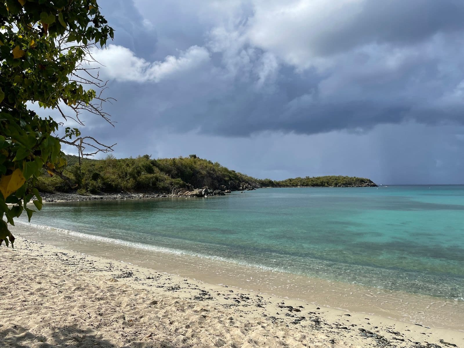
Little Lameshur is the sand beach and Great Lameshur is the rocky one, in the park's own words. You reach Great Lameshur first: the larger bay, a shore of stone rather than sand, and boats at anchor. Little Lameshur, past the point, is where most people stop.
Little Lameshur has picnic tables and barbecue grills, a dirt lot beside the sand and, by most accounts, some shade under the sea grapes behind it. A road-project document filed with the Department of Planning and Natural Resources mentions a recently constructed toilet facility and plans a new parking area beside it, labeled Great Lameshur Beach Parking, to end the roadside parking that has damaged vegetation. No source places a restroom on the sand itself.
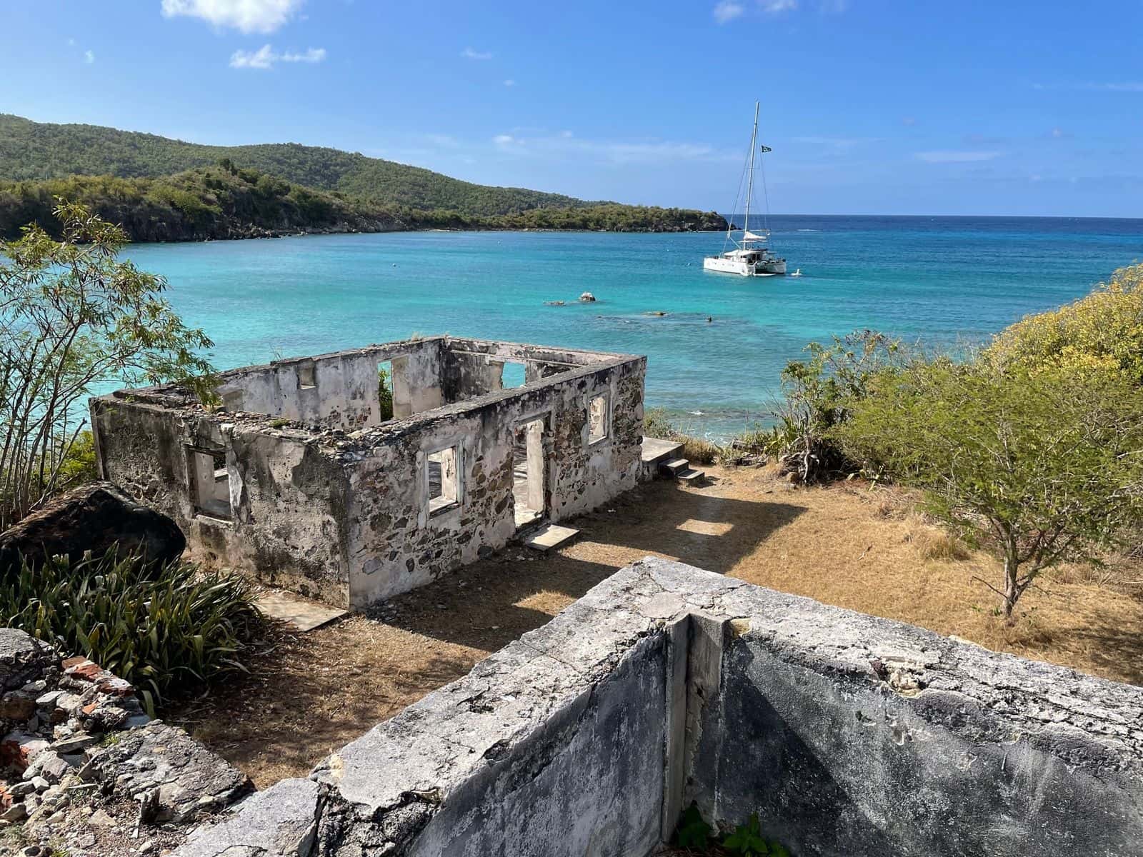
Ruins of the Lameshur plantation stand at the western end of the sand, on the National Register of Historic Places since 1978, and more Danish-era ruins line the Yawzi Point Trail, by the park's description. Great Lameshur has a later history: the Tektite underwater habitat sat on its floor in 1969 and 1970, home for weeks at a time to teams of scientists, one of them the all-woman crew Sylvia Earle led. Most accounts call the bays quiet, the long drive being the reason; one says to expect some company on the sand at Little Lameshur.
The tradeoff is the distance from everything. No food, no drinking water, no rentals, by every source we read, and no source publishes a lifeguard at Lameshur as of October 2026, so swim as if there is none.
Snorkeling at Lameshur Bay: Yawzi Point between the two
Both bays snorkel well, and the point between them is the reason. The National Park Service says both "offer good snorkeling, especially at the tip of Yawzi point, the spit of land that separates the two bays", with fish and other creatures in the rocky coral shorelines. The side trails off the Yawzi Point Trail drop to small rocky beaches the park describes as quiet snorkel entry spots.
Little Lameshur is the sheltered swim, with the easy entry from the sand; the waves build as you work east toward Yawzi Point. Great Lameshur is the harder swim: the entry is over rock and the waves near the point can get large, so keep it for a calm day and a confident swimmer.
Trails that start at the sand
The Yawzi Point Trail leaves the beach for the crest of the point: 0.3 mile, 30 to 50 minutes there and back by the park's reckoning, easy, past stone ruins of homes from the Danish colonial period, with side trails to small rocky beaches. The park calls it narrow and rocky, not accessible, and buggy early and late in the day.
Two longer trails leave the same sand, the Lameshur Bay Trail west to join the Reef Bay Trail and the Bordeaux Mountain Trail up to Bordeaux Mountain Road; the park publishes no lengths for either. On the way in, the Tektite Trail, 0.7 mile, starts on the right of Lameshur Road at the first switchback and begins with a moderately strenuous climb onto Cabritte Horn Point, per the National Park Service. Leashed dogs are allowed on all of these trails and on none of the beaches.
Lameshur Bay or Salt Pond Bay: 45 minutes or 41
Salt Pond Bay if the rental agreement rules out the road, or if the road is shut for its rebuild; Lameshur if the vehicle is allowed and the day includes a trail. Salt Pond Bay's lot is 41 minutes from Cruz Bay on pavement, then a walk down to the sand; Lameshur is four minutes further and you park beside the sand.
Suits a second or third trip with a jeep the contract allows on this road, a snorkeler who wants Yawzi Point, and a hiker linking the beach to Reef Bay, each after a call to confirm the road is open. Not a rental sedan, and not a day that depends on buying lunch.
Photos of Lameshur Bay
Questions people ask about Lameshur Bay
- Where is Lameshur Bay on St. John?
- Lameshur Bay is on the south shore of St. John in the US Virgin Islands, within the national park, past Salt Pond Bay at the end of the road south from Coral Bay. It is two bays, Great Lameshur and Little Lameshur, divided by Yawzi Point. The National Park Service puts them about five miles from Coral Bay.
- Do you need four-wheel drive for Lameshur Bay?
- Four-wheel drive is what the National Park Service recommends, because the access road is rocky, and the park says many car rentals prohibit driving on it, so check with the rental company first. The park's alerts feed posted no closure of the road on Oct 8, 2026; call the Cruz Bay Visitor Center at (340) 776-6201 before you drive out, because a rebuild that will close it is pending.
- Is there a fee at Lameshur Bay?
- No. Great and Little Lameshur are both free: the National Park Service requires no entrance pass and charges nothing for private vehicles, as of October 2026. Trunk Bay, on the North Shore, is the one St. John beach with a fee.
Written by Virgin Islands Villas. Facts verified Oct 9, 2026. Updated Oct 16, 2026.